
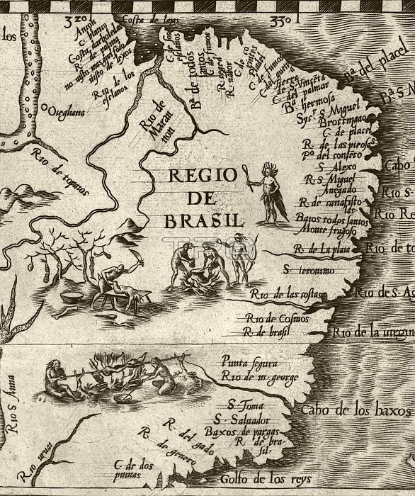
Cannibalism in Brazil. 16th-century cropped map, showing cannibals in the western region of Brazil dismembering and cooking humans. The Amazon is partly visible at top left, with the rivers at upper left being the Araguaia and Tocantins. Numerous other rivers are labelled along the Atlantic coastline, southwards to the area marked 'Golfo de los reys', where modern-day Rio de Janeiro is located. This image was cropped from a map of America produced by the Spanish cartographer Diego Gutierrez in 1562. The map was titled 'Americae sive qvartae orbis partis nova et exactissima descriptio'. It was engraved by the Flemish artist Hieronymous Cock.
| px | px | dpi | = | cm | x | cm | = | MB |
Details
Creative#:
TOP16028999
Source:
達志影像
Authorization Type:
RM
Release Information:
須由TPG 完整授權
Model Release:
N/A
Property Release:
N/A
Right to Privacy:
No
Same folder images:
 Loading