
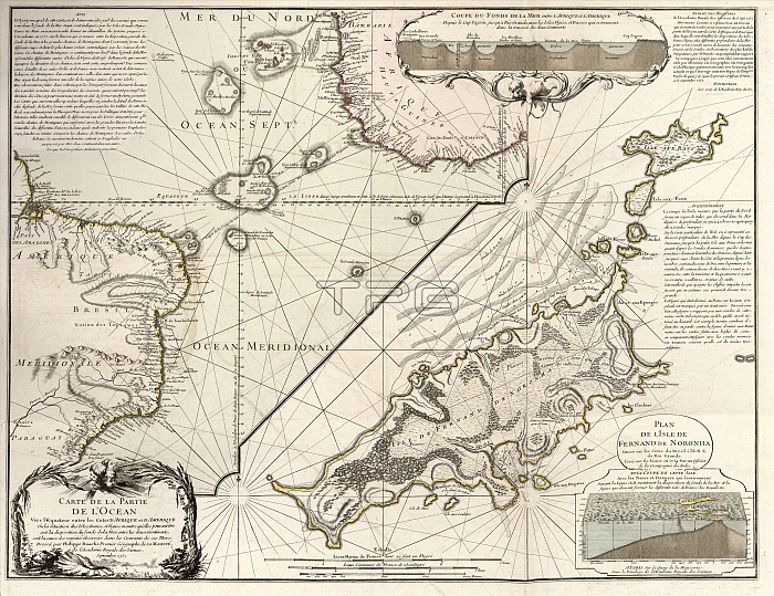
Map of Fernando de Noronha. 18th-century map. This island is part of an archipelago of 21 islands and islets in the Atlantic Ocean, 354 kilometres off the Brazilian coast. The labels and inscription are in French. This map is from 'Cartes et tables de la geographie physique ou naturelle' (1757) by French geographers and cartographers Philippe Buache (1700-1773) and Guillaume de l'Isle (1675-1726).
| px | px | dpi | = | cm | x | cm | = | MB |
Details
Creative#:
TOP16028993
Source:
達志影像
Authorization Type:
RM
Release Information:
須由TPG 完整授權
Model Release:
N/A
Property Release:
N/A
Right to Privacy:
No
Same folder images:
1700s175718thcenturyarchipelagoartworkatlanticoceancartesettablesdelageographiephysiqueounaturellecartographyfernandodenoronhafrenchfrenchlanguagegeographicalgeographyguillaumedel'isleguillaumedelislehistoricalhistoryillustrationislandlabellabeledlabelledlabelsmapno-onenobodyphilippebuachephysicalgeograhytext
1700s175718tharchipelagoartworkatlanticbuachecartescartographycenturydedededelisleetfernandofrenchfrenchgeograhygeographicalgeographiegeographyguillaumeguillaumehistoricalhistoryillustrationislandl'islelalabellabeledlabelledlabelslanguagemapnaturelleno-onenobodynoronhaoceanouphilippephysicalphysiquetablestext
 Loading