
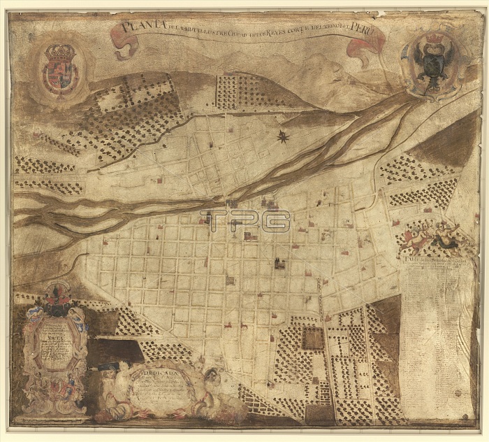
Map of Lima. 17th-century map of the street plan of Lima, Peru. The inscription at lower left refers to the founding of the city by the Spanish in 1535 and refers to Charles V, the Holy Roman Emperor (Charles I of Spain). It was founded in the Rimac valley as 'Ciudad de los Reyes' (City of the Kings) following the conquest of the Incas by Francisco Pizarro. The Rimac River runs across upper centre. The map title (in Castilian Spanish) is: 'Planta de la muy yllustre ciudad de los reyes corte del reino del Peru'. The map dates from 1674 (before the Walls of Lima were built between 1684 and 1687), and was drawn for the merchant Bernardo Clemente Principe.
| px | px | dpi | = | cm | x | cm | = | MB |
Details
Creative#:
TOP16028965
Source:
達志影像
Authorization Type:
RM
Release Information:
須由TPG 完整授權
Model Release:
N/A
Property Release:
N/A
Right to Privacy:
No
Same folder images:
 Loading