
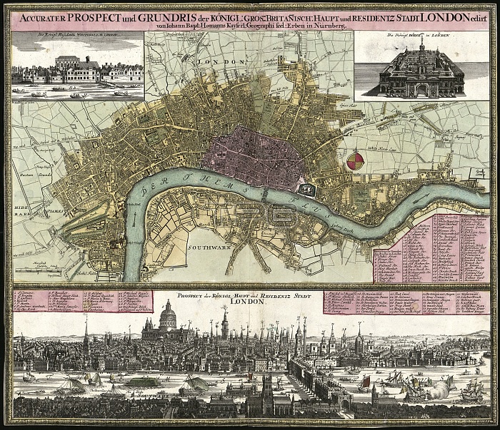
Map of London. 18th-century German map of London, capital city of the UK, with a view looking northwards across ships on the River Thames (across bottom). Corner illustrations show the Palace of Whitehall (top left) and the Royal Exchange (top right). This is the second Royal Exchange (Jarman, 1669). The keys (pink) list prominent places and landmarks, including numerous churches. The view shows St Paul's Cathedral, and the buildings on Old London Bridge, the only bridge crossing this part of the Thames. Inns and theatres are shown in Southwark on the south bank. This 1740s map is by German cartographer Johann Baptist Homann (1663-1724).
| px | px | dpi | = | cm | x | cm | = | MB |
Details
Creative#:
TOP16005514
Source:
達志影像
Authorization Type:
RM
Release Information:
須由TPG 完整授權
Model Release:
N/A
Property Release:
N/A
Right to Privacy:
No
Same folder images:
 Loading