
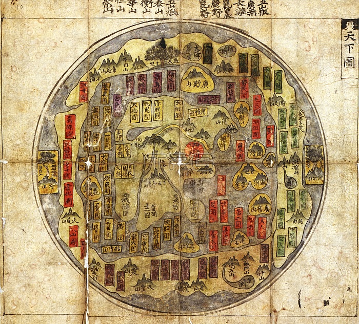
Korean world map. 18th-century map of the world showing a traditional depiction ('Chonhado', Map of the World) of the Korean belief that the Earth was flat. The form and circular shape of such Korean maps were largely unchanged from the earliest known examples in the 16th century. The main features were an internal continent surrounded by a sea, with an external continent and sea around the edge. The names and descriptions of places (such as mountains and rivers) would include references to the religious philosophy of Taoism. This map is from an 18th-century atlas manuscript version of the Korean atlas 'Chonha Chido'.
| px | px | dpi | = | cm | x | cm | = | MB |
Details
Creative#:
TOP16005512
Source:
達志影像
Authorization Type:
RM
Release Information:
須由TPG 完整授權
Model Release:
N/A
Property Release:
N/A
Right to Privacy:
No
Same folder images:
 Loading