
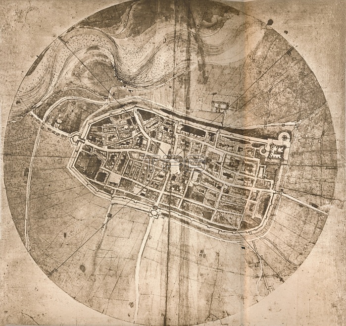
A map representing the town of Imola, Italy, c1472-c1519 (1883). Artist: Leonardo da Vinci.
| px | px | dpi | = | cm | x | cm | = | MB |
Details
Creative#:
TOP15938342
Source:
達志影像
Authorization Type:
RM
Release Information:
須由TPG 完整授權
Model Release:
No
Property Release:
No
Right to Privacy:
No
Same folder images:
cityroadItalyItalianstreettownartsmapcountryartgeographylaneavenueRenaissancelocationcircularcenturydrawingplancartographyB&WMONOCHROME19thcenturyBolognablack&whiteblackandwhiteB/W16thcenturyEmilia-Romagnanineteenthcenturysixteenthcentury15thcenturyThePrintCollectorfifteenthcenturymap-makingTGNImolamapLeonardodaVinciLeonardodeVinciRichterJeanPaulVinciLeonardodadaVinciLeonardoPrintCollector29JeanPaulRichter
&15th16th19thB&WB/WBolognaCollectorCollector29Emilia-RomagnaImolaItalianItalyJeanJeanLeonardoLeonardoLeonardoLeonardoMONOCHROMEPaulPaulPrintPrintRenaissanceRichterRichterTGNTheVinciVinciVinciVinciandartartsavenueblackblackcartographycenturycenturycenturycenturycenturycenturycenturycircularcitycountrydadadadedrawingfifteenthgeographylanelocationmapmapmap-makingnineteenthplanroadsixteenthstreettownwhitewhite
 Loading