
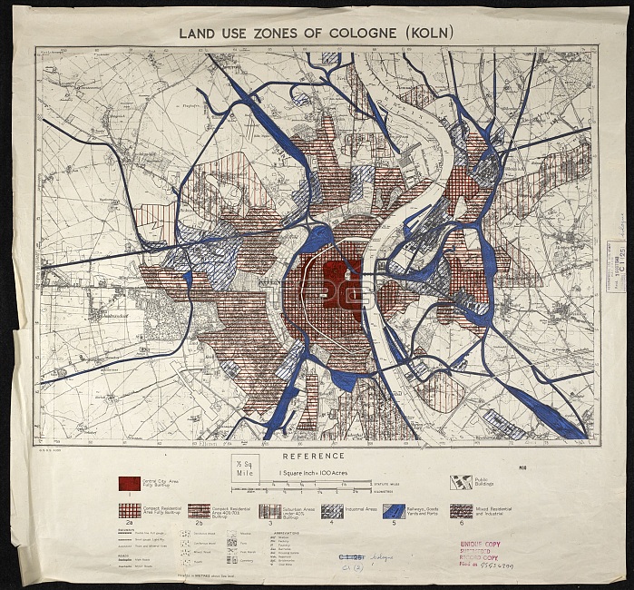
War map of Cologne. British military map of Cologne, Germany, overprinted to show vulnerability to high explosive and incendiary bombing. Produced by the Great Britain Air Ministry, 1943-1944.
| px | px | dpi | = | cm | x | cm | = | MB |
Details
Creative#:
TOP15203271
Source:
達志影像
Authorization Type:
RM
Release Information:
須由TPG 完整授權
Model Release:
No
Property Release:
No
Right to Privacy:
No
Same folder images:
1900s19401943194420thcenturyaerialviewartworkbombbombingbritishcartographycitycologneeuropeeuropeanextractfromabovegeographygeographicalgermangermanygreatbritainairministryhistoricalhistoryillustrationkolnlookingdownmapmilitaryno-onenobodyoverprintedsecondworldwarurbanvulnerabilitywarwarofficewarfareww2wwiizonemap
1900s19401943194420thaboveaerialairartworkbombbombingbritainbritishcartographycenturycitycolognedowneuropeeuropeanextractfromgeographicalgeographygermangermanygreathistoricalhistoryillustrationkolnlookingmapmapmilitaryministryno-onenobodyofficeoverprintedsecondurbanviewvulnerabilitywarwarwarwarfareworldww2wwiizone
 Loading