
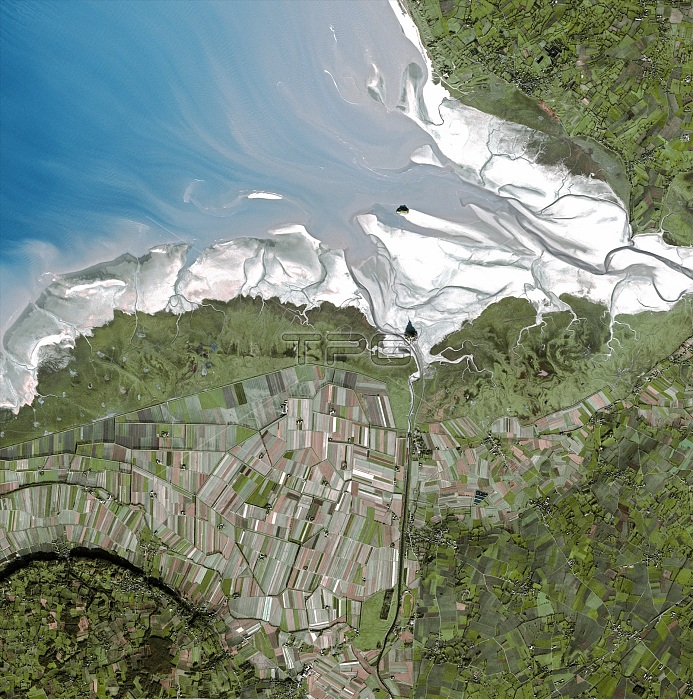
Mont Saint-Michel bay, satellite image. North is at top. The island of Mont Saint-Michel is at centre, at the mouth of the Couesnon River (running from the south) on the Atlantic coast of Normandy, France. Shadows are cast northwards. The rivers See and Selune flow from right. Mont Saint-Michel, a UNESCO World Heritage Site, used to be a tidal island, but since the late 1800s has been accessible by a raised causeway from the mainland. It is surrounded by extensive mudflats at low tide. The island in the estuary at upper centre is Tombelaine. Fields dominate the surrounding land. This image was obtained by the SPOT 5 satellite on 17 December 2003.
| px | px | dpi | = | cm | x | cm | = | MB |
Details
Creative#:
TOP14866185
Source:
達志影像
Authorization Type:
RM
Release Information:
須由TPG 完整授權
Model Release:
N/A
Property Release:
No
Right to Privacy:
No
Same folder images:
 Loading