
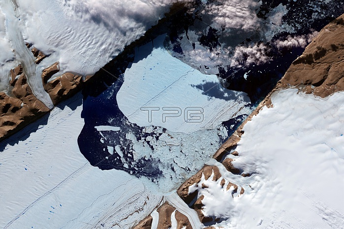
Ice island from Petermann Glacier. Satellite image of the massive ice island that broke free of the Petermann Glacier in north-western Greenland in July 2012. This detailed image reveals that the iceberg covers an area of about 32.3 square kilometers (12.5 square miles). The Petermann Glacier (a tidewater glacier) terminates in a giant floating ice tongue (lower left). The ice island had formed by 16 July, with this image obtained on 21 July 2012 by the Advanced Spaceborne Thermal Emission and Reflection Radiometer (ASTER) on NASA's Terra satellite. The previous times an iceberg of comparable size broke off the Petermann Glacier were in 2008 and 2010.
| px | px | dpi | = | cm | x | cm | = | MB |
Details
Creative#:
TOP14865027
Source:
達志影像
Authorization Type:
RM
Release Information:
須由TPG 完整授權
Model Release:
N/A
Property Release:
No
Right to Privacy:
No
Same folder images:
 Loading