
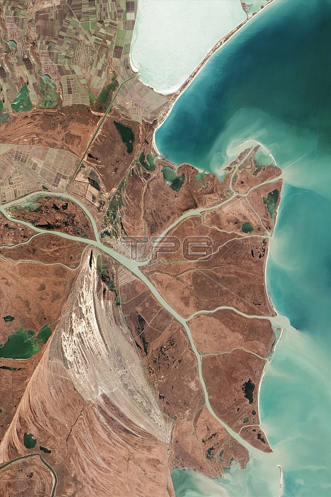
Danube Delta. Satellite image focused on the northernmost Chilia (or Kilia) lobe of the Danube Delta, the second largest river delta in Europe. This delta is made up of a number of lobes and drains over 800,000 square kilometres of land across 19 countries. Where the river reaches the Black Sea (upper right), another remarkable delta has formed an area dubbed the 'Everglades of Europe'. Imaged by the Advanced Land Imager (ALI) on NASA's Earth Observing-1 (EO-1) satellite, on 5th February 2013.
| px | px | dpi | = | cm | x | cm | = | MB |
Details
Creative#:
TOP14864967
Source:
達志影像
Authorization Type:
RM
Release Information:
須由TPG 完整授權
Model Release:
N/A
Property Release:
No
Right to Privacy:
No
Same folder images:
 Loading