
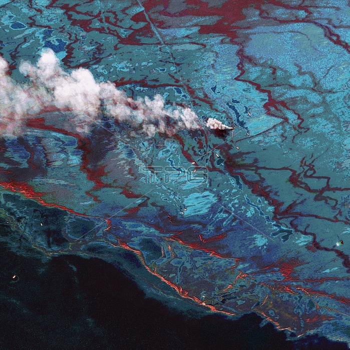
Gulf of Mexico oil spill. Satellite image showing the clean-up operation of the oil spill caused by the explosion of the Deepwater Horizon oil rig in the Gulf of Mexico on 20th April 2010. The different colours distinguish between water, oil and dispersant. At upper centre surface oil is being burned off, causing a plume of smoke. Around it are boats carrying inflatable booms to help contain the spill. Over five thousand barrels of oil a day leaked into the Gulf of Mexico, 80 kilometres from the coast of Louisiana, USA, harming local wildlife and fishing industries. Image taken by the WorldView-2 satellite on 15MBth June 2010.
| px | px | dpi | = | cm | x | cm | = | MB |
Details
Creative#:
TOP13790569
Source:
達志影像
Authorization Type:
RM
Release Information:
須由TPG 完整授權
Model Release:
N/A
Property Release:
No
Right to Privacy:
No
Same folder images:
 Loading