
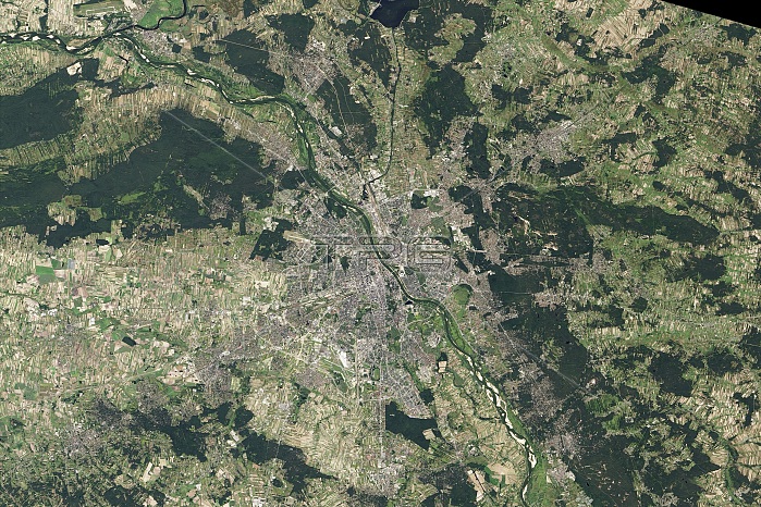
Warsaw in 2013. Satellite image of Warsaw, the capital city of Poland, and its surroundings. North is at top. The city is at centre, on the Vistula River, while surrounding it here are various suburbs that make up the Warsaw metropolitan area. The surrounding land also includes agricultural fields and forests. The city of Warsaw itself covers an area of 51MB7 square kilometres, while the Warsaw metropolitan area covers 30MB00 square kilometres. As of 2013, the metropolitan area had a population of 2.66MB million people. Image data obtained on 8 September 2013 by the Operational Land Imager (OLI) on the Landsat 8 satellite.
| px | px | dpi | = | cm | x | cm | = | MB |
Details
Creative#:
TOP13790548
Source:
達志影像
Authorization Type:
RM
Release Information:
須由TPG 完整授權
Model Release:
N/A
Property Release:
No
Right to Privacy:
No
Same folder images:
 Loading