
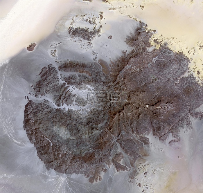
Jebel Uweinat mountains, satellite image. North is at top. This mountain range (peak elevation: 1934 metres) is located on the Egyptian-Sudanese-Libyan border. The area contains prehistoric petroglyphs. Engraved in sandstone, images of giraffes, lions, ostriches, gazelles, and humans date from when the region was wetter and vegetated. The western mountains are intrusive granite, arranged in a ring shape (centre left), while the western slopes include wells, bushes and grass. The eastern areas are sandstone plateaus. The area shown is 40 kilometres across. Image data acquired on 17 March 2012, by the ASTER instrument on NASA's Terra satellite.
| px | px | dpi | = | cm | x | cm | = | MB |
Details
Creative#:
TOP11719493
Source:
達志影像
Authorization Type:
RM
Release Information:
須由TPG 完整授權
Model Release:
NO
Property Release:
NO
Right to Privacy:
No
Same folder images:
 Loading