
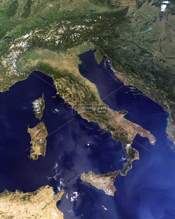
Italy and the surrounding region, satellite image. North is at top. Water is blue, vegetation is dark green, drier areas are brown, clouds and snow and ice are white, and developed areas are grey. Sicily is at lower centre. At left are the islands of Corsica (top) and Sardinia (bottom). Parts of Tunisia and Algeria are are at bottom left. The Alps and Switzerland are at upper left. Austria is at top. Across the Adriatic from Italy are Croatia, Bosnia and Herzegovinia, Montenegro, and Serbia. Hungary is at top right. Image data obtained on 22 August 2011 by the Moderate Resolution Imaging Spectroradiometer (MODIS) instrument on NASA's Terra satellite.
| px | px | dpi | = | cm | x | cm | = | MB |
Details
Creative#:
TOP11247510
Source:
達志影像
Authorization Type:
RM
Release Information:
須由TPG 完整授權
Model Release:
No
Property Release:
No
Right to Privacy:
No
Same folder images:
 Loading