
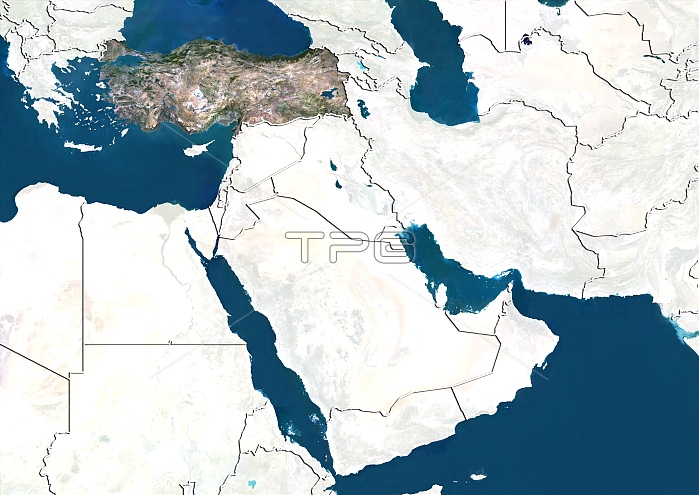
Turkey, satellite image. North is at top. Satellite image showing Turkey, with the surrounding countries shaded out. Turkey is a Eurasian country. It is bordered by eight countries: Bulgaria to the northwest; Greece to the west; Georgia to the northeast; Armenia, Iran and the Azerbaijani exclave of Nakhchivan to the east; and Iraq and Syria to the southeast. The Mediterranean Sea (blue, upper left) is to the south; the Aegean Sea is to the west; and the Black Sea (blue, top left) is to the north. The Black Sea (blue, top right) Arabian Peninsula (centre) and Indian Ocean (blue, lower left) can also be seen. Image compiled from data acquired by LANDSAT satellites, in 2012.
| px | px | dpi | = | cm | x | cm | = | MB |
Details
Creative#:
TOP10392511
Source:
達志影像
Authorization Type:
RM
Release Information:
須由TPG 完整授權
Model Release:
No
Property Release:
No
Right to Privacy:
No
Same folder images:
 Loading