
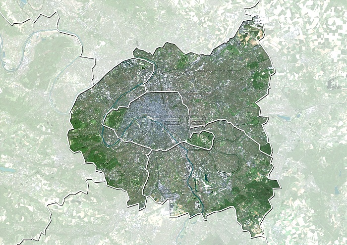
Ile-de-France, France. North is at top. Natural colour satellite image of a close-up on the Ile-de-France administrative region of France, showing the Greater Paris Area (green) with the surrounding areas shaded out. The areas shown are: Paris (centre), and the departments of Seine-Saint-Denis (upper right), Seine-et-Marne (right), Val-de-Marne, (lower right), Hauts-de-Seine (lower left), Val-d'Oise (top centre), Essonne (bottom centre), and Yvelines (left). France is located in Western Europe. Paris is the capital and largest city of France. Bot it and Seine-Saint-Denis are located in northern France, at the heart of the Ile-de-France region. Image compiled from data acquired by the LANDSAT 5 and 7 satellites, in 2000. Images highlighting all other
| px | px | dpi | = | cm | x | cm | = | MB |
Details
Creative#:
TOP10277478
Source:
達志影像
Authorization Type:
RM
Release Information:
須由TPG 完整授權
Model Release:
NO
Property Release:
NO
Right to Privacy:
No
Same folder images:
 Loading