
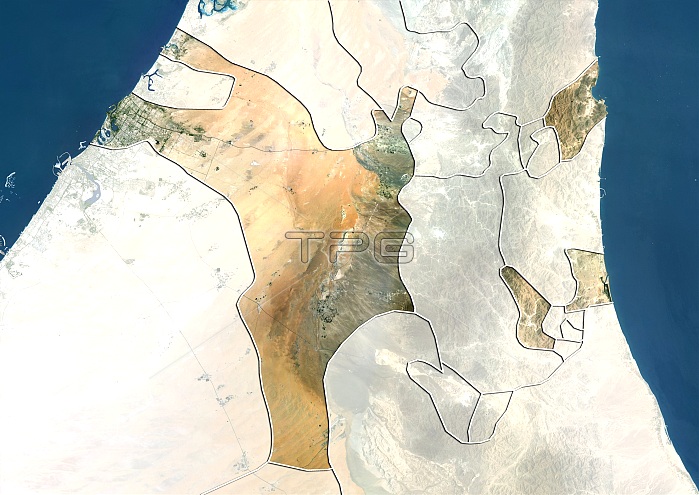
Sharjah, United Arab Emirates. North is at top. Natural colour satellite image showing the emirate of Sharjah, United Arab Emirates (UAE), with the surrounding emirates shaded out. UAE is located in the southeast of the Arabian Peninsula in Western Asia, on the Persian Gulf (blue). It is a federation of seven emirates (principalities), each governed by a hereditary emir, with a single national president. The constituent emirates are: Abu Dhabi, Ajman, Dubai, Fujairah, Ras al-Khaimah, Sharjah, and Umm al-Quwain. UAE is bordered by Oman (lower right), and Saudi Arabia (lower left). Qatar (upper left) and the Gulf of Oman (blue, upper right) can also be seen. Image compiled from data acquired by the LANDSAT 5 and 7 satellites, in 2000. Images highlighting
| px | px | dpi | = | cm | x | cm | = | MB |
Details
Creative#:
TOP10277451
Source:
達志影像
Authorization Type:
RM
Release Information:
須由TPG 完整授權
Model Release:
NO
Property Release:
NO
Right to Privacy:
No
Same folder images:
 Loading