
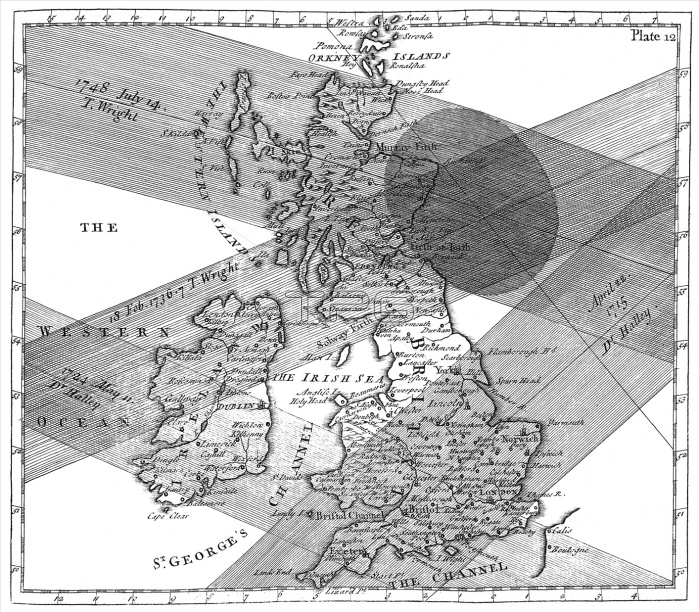
Solar eclipse paths. Historical map of the paths of four solar eclipses over Great Britain during the 1700s. The map is from the book 'The use of globes', published by astronomer Thomas Wright (1711-1786), London in 1740. A total solar eclipse occurs when the Earth, moon and Sun are in direct alignment and the moon's shadow is cast on the Earth's surface. The shaded areas represent the path of the moving lunar shadow in April 1715, May 1724, February 1736 and July 1748. The oval shape (top right) shows the area under totality for the 1748 eclipse.
| px | px | dpi | = | cm | x | cm | = | MB |
Details
Creative#:
TOP10242251
Source:
達志影像
Authorization Type:
RM
Release Information:
須由TPG 完整授權
Model Release:
N/A
Property Release:
N/A
Right to Privacy:
No
Same folder images:
 Loading