
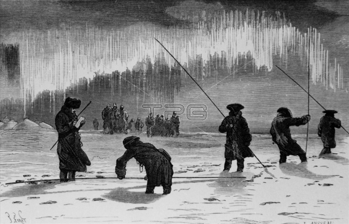
Measuring the Earth's shape. Engraving of the expedition led by French scientist Pierre-Louis de Maupertuis (1698-1759) to measure the shape of the Earth. The Aurora Borealis (Northern Lights) is in the upper frame. Maupertuis (at left) led an expedition to Lapland, northern Scandinavia, to measure the length of one degree of longitude. The distance was measured on the ground by means of rods and Maupertuis took astronomical observations to determine their position. Another French scientist, La Condamine, took similar measurements around the equator. Their results showed that the Earth bulged at the equator, a theory first proposed by British scientist Isaac Newton.
| px | px | dpi | = | cm | x | cm | = | MB |
Details
Creative#:
TOP10242119
Source:
達志影像
Authorization Type:
RM
Release Information:
須由TPG 完整授權
Model Release:
N/A
Property Release:
N/A
Right to Privacy:
No
Same folder images:
 Loading