
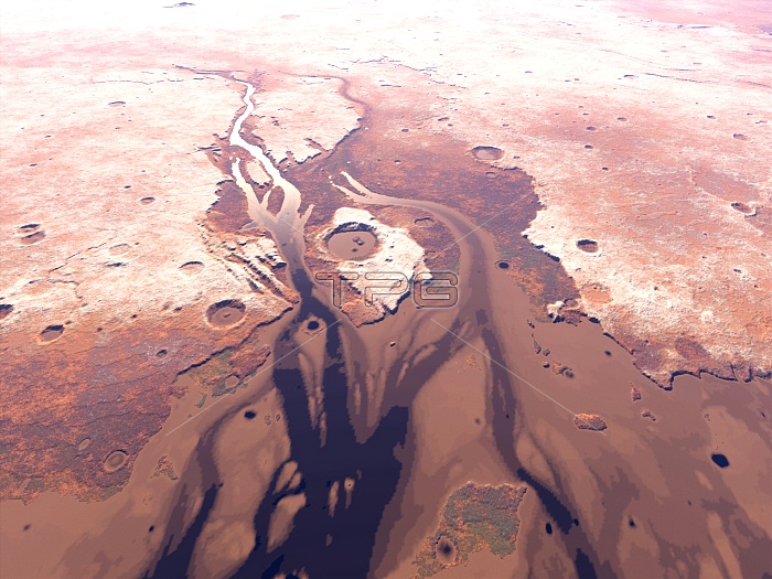
Rivers on Mars. Computer artwork looking west over the mouth of a river thought to have created the Kasei Valles (Kasei Valley, down left) on Mars 3.5 billion years ago. Meltwater flowed from top, past the Sharanov Crater (centre), entering the sea in the Chryse Planitia (Chryse Plain, not seen, off bottom). Ice (white) is on the heights of Lunae Planum (left) and Tempa Terra (right). The image is hundreds of kilometres across. The water was ultimately lost due to the thin Martian atmosphere and weak gravity. Mars is now a desert world. The topography was drawn with Terragen software, using data from the laser altimeter on the Mars Global Surveyor probe.
| px | px | dpi | = | cm | x | cm | = | MB |
Details
Creative#:
TOP10238011
Source:
達志影像
Authorization Type:
RM
Release Information:
須由TPG 完整授權
Model Release:
N/A
Property Release:
N/A
Right to Privacy:
No
Same folder images:
 Loading