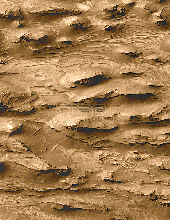
Martian rock layers. Layered sedimentary rock terrain on the surface of Mars, thought to indicate the presence of surface water in the planet's history. Rocks such as this are formed by deposition at regular intervals. On Earth, this occurs in energetic underwater environments, implying that a lake or sea may once have covered this area. Water on Mars could have formed a habitat for life, and the area may hold fossils. This terrain is in the southern part of Candor Chasma, a valley system on Mars. This image, measuring 1.5x2.9 kilometres, was taken by the Mars Orbiter Camera on the Mars Global Surveyor spacecraft orbiting Mars. Data analysed in 2000.
| px | px | dpi | = | cm | x | cm | = | MB |
Details
Creative#:
TOP10237981
Source:
達志影像
Authorization Type:
RM
Release Information:
須由TPG 完整授權
Model Release:
N/A
Property Release:
N/A
Right to Privacy:
No
Same folder images:

 Loading