
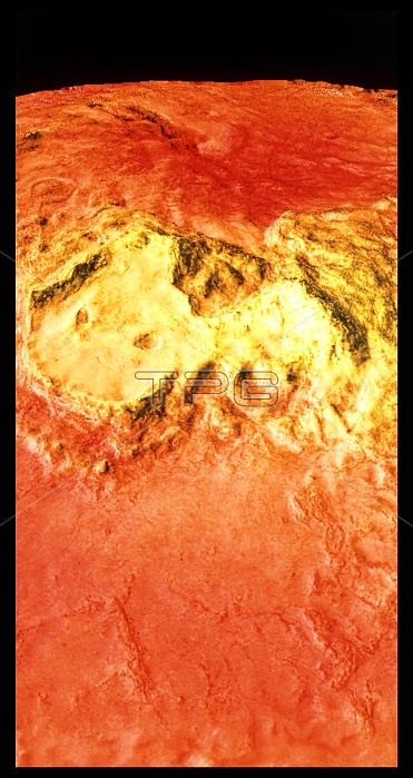
Colour-coded topographic map of the region surrounding Venus' north pole. Bright yellow areas are the highest & dark orange areas the lowest. The yellow region is Ishtar Terra and contains Lakshmi Planum (left) and the Maxwell Montes (right), the highest mountains on Venus. The two crater-like depressions in Lakshmi Planum are the calderas of two volcanoes, Colette (left) & Sacajawea (right). The map was compiled using data from the Soviet Venera 15 & 16 spacecraft, the American Pioneer Venus spacecraft and the Arecibo radio telescope in Puerto Rico.
| px | px | dpi | = | cm | x | cm | = | MB |
Details
Creative#:
TOP10237546
Source:
達志影像
Authorization Type:
RM
Release Information:
須由TPG 完整授權
Model Release:
N/A
Property Release:
N/A
Right to Privacy:
No
Same folder images:
 Loading