
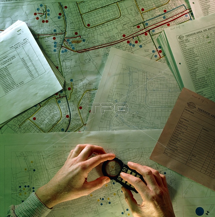
Water mains mapping. Hands using a device to send the coordinates of water mains on a street map to a Geographic Information System (GIS). A GIS is a computer system on which geographical data can be inputted, stored, manipulated and displayed. This aids the water company's management of the water system, as well as improving the efficiency with which improvements and repairs may be carried out.
| px | px | dpi | = | cm | x | cm | = | MB |
Details
Creative#:
TOP10234139
Source:
達志影像
Authorization Type:
RM
Release Information:
須由TPG 完整授權
Model Release:
N/A
Property Release:
N/A
Right to Privacy:
No
Same folder images:
 Loading