
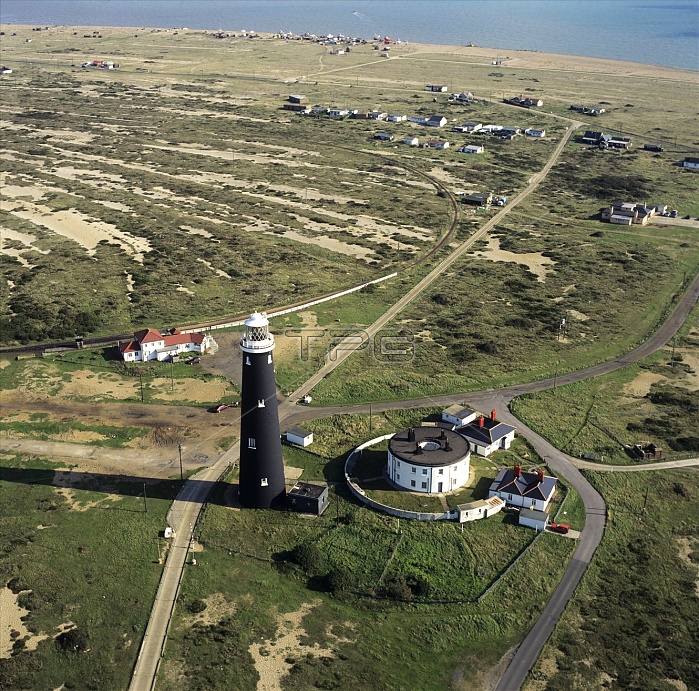
The old Dungeness lighthouse, aerial photograph. Dungeness, Kent, is located on the tip of a low- lying tooth-shaped area of shingle deposits known as a cuspate foreshore. This constructional landform has formed by the combination of longshore drift in both a west-east direction and a east-west direction, with waves hitting the coast at right angles to each other. The result is deposition on the eastward side and erosion of the westward side of the coastline. The old lighthouse was built in 1901 and was originally much closer to the shore. Its current position indicates the rate of prograding. To the left of the lighthouse are successive ridges built up by storm waves since the late Holocene epoch.
| px | px | dpi | = | cm | x | cm | = | MB |
Details
Creative#:
TOP10233114
Source:
達志影像
Authorization Type:
RM
Release Information:
須由TPG 完整授權
Model Release:
N/A
Property Release:
N/A
Right to Privacy:
No
Same folder images:
 Loading