
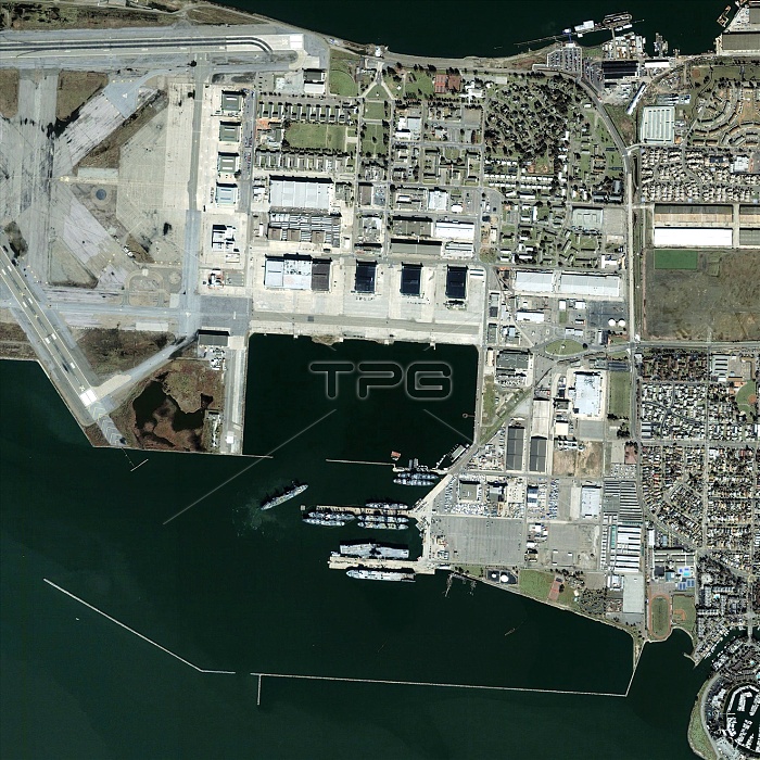
Alameda Point. Satellite image of Alameda Point, a former US Navy base near Oakland, California, USA. North is at top. The area seen is on the western tip of Alameda Island, just offshore from Oakland, in San Francisco Bay. The waters of Inner Harbour are across top, and of San Francisco Bay across bottom. Runways (top left) and aircraft carriers (lower centre) are seen. One of them is the USS Hornet, now run as a museum. The naval base, built in the late 1930s, was closed in 1997. The runways are part of a nature reserve, and the whole area is slowly being converted to civilian uses. The area shown is some 3 kilometres across. Image taken by the Ikonos satellite on 18 February 2003.
| px | px | dpi | = | cm | x | cm | = | MB |
Details
Creative#:
TOP10232687
Source:
達志影像
Authorization Type:
RM
Release Information:
須由TPG 完整授權
Model Release:
N/A
Property Release:
N/A
Right to Privacy:
No
Same folder images:
 Loading