
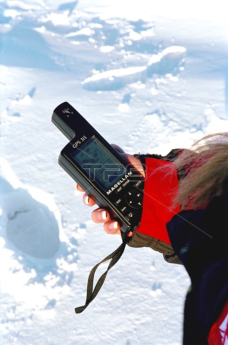
Global positioning system (GPS) receiver held in a hand. 24 GPS satellites trace precision orbits around the Earth. Each satellite transmits radio signals that can be detected by this receiver. Three signals allow calculation of latitude and longitude. A fourth signal allows altitude calculations. Transmission of time data allows the calculation of local time. This is a Magellan GPS 315 receiver being used in the Canadian Arctic.
| px | px | dpi | = | cm | x | cm | = | MB |
Details
Creative#:
TOP10231880
Source:
達志影像
Authorization Type:
RM
Release Information:
須由TPG 完整授權
Model Release:
N/A
Property Release:
N/A
Right to Privacy:
No
Same folder images:
 Loading