
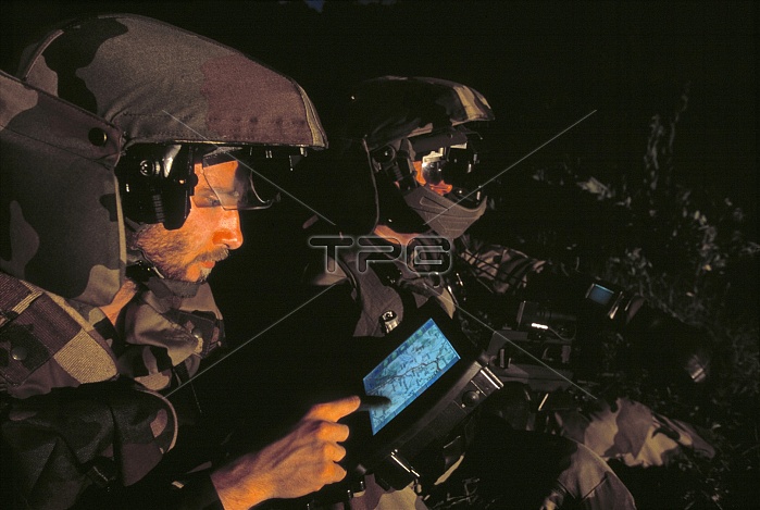
Soldiers using global positioning system (GPS) equipment. GPS relies on a network of 24 US military satellites. By detecting signals broadcast from the satellites, GPS receivers can calculate their current latitude and longitude to a high degree of precision (within 10 to 20 metres). Altitude can also be determined. The system is available for use by civilians. These soldiers are testing the French FELIN infantry system, which integrates navigation, communication, targetting and sensor systems. Deployment of FELIN is planned for 2006.
| px | px | dpi | = | cm | x | cm | = | MB |
Details
Creative#:
TOP10231878
Source:
達志影像
Authorization Type:
RM
Release Information:
須由TPG 完整授權
Model Release:
N/A
Property Release:
N/A
Right to Privacy:
No
Same folder images:
 Loading