
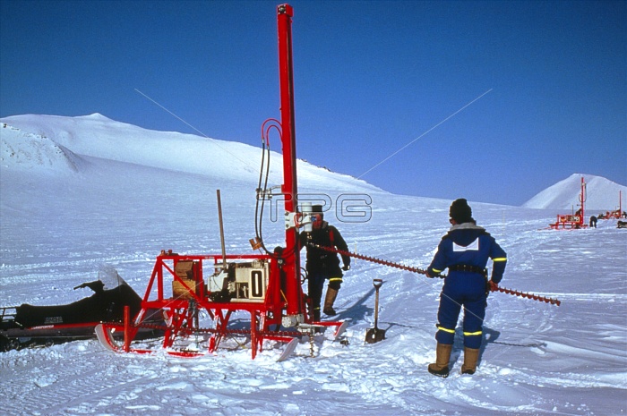
A line of drilling rigs is used to conduct a seismic survey on a glacier in the Heer Land region of Spitsbergen, the Norwegian island in the Svalbard Archipelago on the edge of the Arctic Ocean. The specially designed rigs are mounted on sledge runners. Twenty-metre deep holes are drilled at 50-metre intervals across the glacier surface. Charges detonated in the holes emit shock waves which bounce back from the rock strata below to provide a seismic profile of the area. The survey was conducted in 1986 as part of oil exploration on Spitsbergen.
| px | px | dpi | = | cm | x | cm | = | MB |
Details
Creative#:
TOP10226830
Source:
達志影像
Authorization Type:
RM
Release Information:
須由TPG 完整授權
Model Release:
N/A
Property Release:
N/A
Right to Privacy:
No
Same folder images:
 Loading