
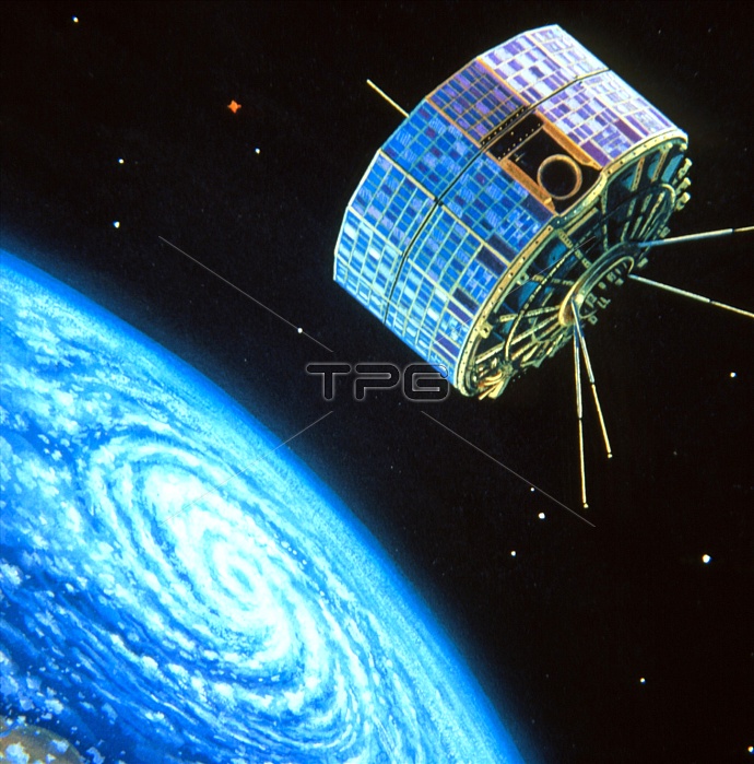
Artwork showing one of the TIROS (Television and Infrared Observation Satellite) satellites orbiting around the Earth. The TIROS programme began as a joint NASA/US Department of Defence project for meteorological applications. Between 1960 and 1967 10 TIROS satellites were launched which returned more than 500, 000 cloud-cover images of the Earth. The first photo-mosaic of the whole Earth, made up by 450 high-quality TIROS images, was obtained in 1965 after the TIROS 9 surveyed the polar regions.
| px | px | dpi | = | cm | x | cm | = | MB |
Details
Creative#:
TOP10226316
Source:
達志影像
Authorization Type:
RM
Release Information:
須由TPG 完整授權
Model Release:
N/A
Property Release:
N/A
Right to Privacy:
No
Same folder images:
 Loading