
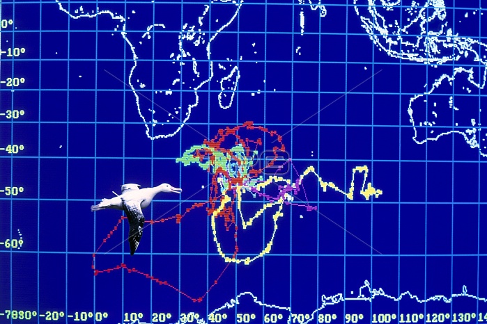
Albatross movement map. Computer monitor view of the movements of an albatross (Diomedea sp., lower left). The coloured lines indicate the albatross' flight paths around the French-owned Crozet Islands in the southern Indian Ocean. This map was made by capturing albatrosses and placing transmitters on their backs. Signals from the transmitters can be picked up and used to follow their journeys. Maps such as this are used to study how far albatrosses fly and how often they return to land. Albatrosses are huge birds which mainly live in the southern oceans. They feed on fish and squid, and spend much of their lives at sea.
| px | px | dpi | = | cm | x | cm | = | MB |
Details
Creative#:
TOP10187945
Source:
達志影像
Authorization Type:
RM
Release Information:
須由TPG 完整授權
Model Release:
N/A
Property Release:
N/A
Right to Privacy:
No
Same folder images:
 Loading