
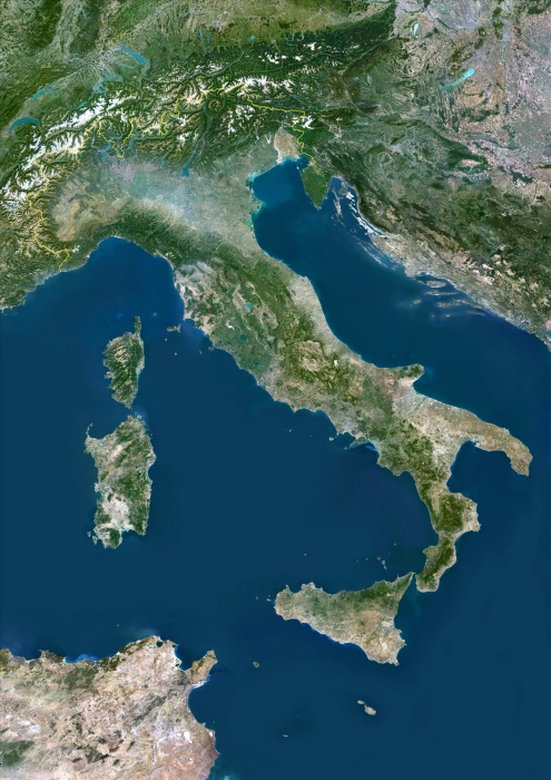
Italy, True Colour Satellite Image With Border. Italy, true colour satellite image with border. Italy comprises the large peninsula at centre, and the large islands of Sicily (lower centre) and Sardinia (centre left). It also encompasses numerous smaller islands. To the northeast of Italy is the Adriatic Sea, southeast of it is the Ionian Sea, southwest of it is the Tyrrhenian Sea, and the Ligurian Sea lies above the French island of Corsica at upper left. The image used data from LANDSAT 5 & 7 satellites.
| px | px | dpi | = | cm | x | cm | = | MB |
Details
Creative#:
TOP09062942
Source:
達志影像
Authorization Type:
RM
Release Information:
須由TPG 完整授權
Model Release:
NO
Property Release:
NO
Right to Privacy:
No
Same folder images:
 Loading