
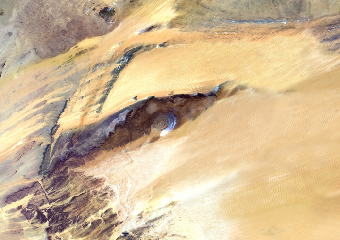
Richat Structure, Mauritania, True Colour Satellite Image. Richat Structure, Mauritania, true colour satellite image. The Richat structure is a geological formation in the Maur Adrar Desert in the African country of Mauritania. Although it resembles an impact crater, the Richat Structure formed when a volcanic dome hardened and gradually eroded, exposing the onion-like layers of rock. Image taken on 13 January 2003 using LANDSAT data.
| px | px | dpi | = | cm | x | cm | = | MB |
Details
Creative#:
TOP09061954
Source:
達志影像
Authorization Type:
RM
Release Information:
須由TPG 完整授權
Model Release:
NO
Property Release:
NO
Right to Privacy:
No
Same folder images:
 Loading