
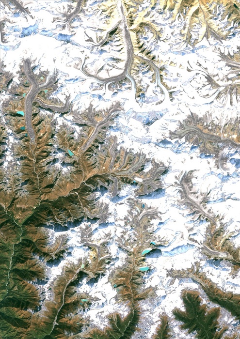
Mount Everest, Nepal & China, True Colour Satellite Image. Mount Everest, true colour satellite image. Mount Everest is the world's highest peak (8850m), surrounded by glakeiers. Its summit ridge marks the border between Nepal and China. Image taken on 17 November 1992 using LANDSAT data.
| px | px | dpi | = | cm | x | cm | = | MB |
Details
Creative#:
TOP09061936
Source:
達志影像
Authorization Type:
RM
Release Information:
須由TPG 完整授權
Model Release:
NO
Property Release:
NO
Right to Privacy:
No
Same folder images:
 Loading