
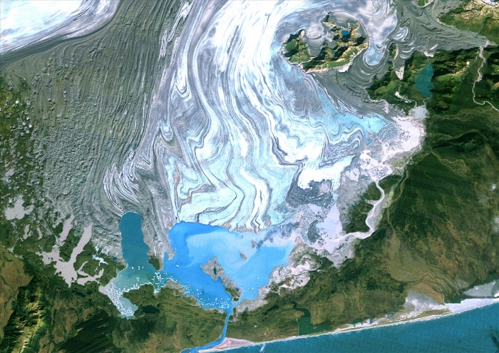
Bering Glacier, Alaska, Usa, True Colour Satellite Image. Satellite image of the Bering Glacier, the largest glacier in North America. It currently terminates in Vitus Lake (South East on the picture), about 10km from the Gulf of Alaska, and flows into the sea through a small outlet. The glacier is bordered by gray moraines. Image taken on 25 September 1986 using LANDSAT data.
| px | px | dpi | = | cm | x | cm | = | MB |
Details
Creative#:
TOP09061912
Source:
達志影像
Authorization Type:
RM
Release Information:
須由TPG 完整授權
Model Release:
NO
Property Release:
NO
Right to Privacy:
No
Same folder images:
 Loading