
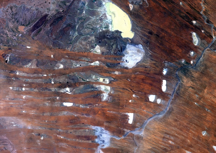
Kalahari Desert, Namibia, True Colour Satellite Image. True colour satellite image of the Kalahari desert, at the frontier between Namibia and South Africa. The dunes are red-coloured by iron oxyds. The blue dots are argillakeeous basins, still filled with water. The white dotes are salted basins that show how dry this plakee is. Image taken on 3 March 1989 using LANDSAT data.
| px | px | dpi | = | cm | x | cm | = | MB |
Details
Creative#:
TOP09061897
Source:
達志影像
Authorization Type:
RM
Release Information:
須由TPG 完整授權
Model Release:
NO
Property Release:
NO
Right to Privacy:
No
Same folder images:
 Loading