
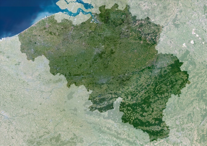
Belgium, True Colour Satellite Image With Mask. Belgium. True colour satellite image of Belgium - with mask . North is at top. Vegetation is green, water is blue and bare ground is light brown. Belgium (darker in colour) is bordered by the Netherlands to the north, Germany to the east, Luxembourg to the south-east and France to the south. The Dutch Westerschelde estuary enters the North Sea at top left. The image used data from LANDSAT 5 & 7 satellites.
| px | px | dpi | = | cm | x | cm | = | MB |
Details
Creative#:
TOP09061636
Source:
達志影像
Authorization Type:
RM
Release Information:
須由TPG 完整授權
Model Release:
NO
Property Release:
NO
Right to Privacy:
No
Same folder images:
 Loading