
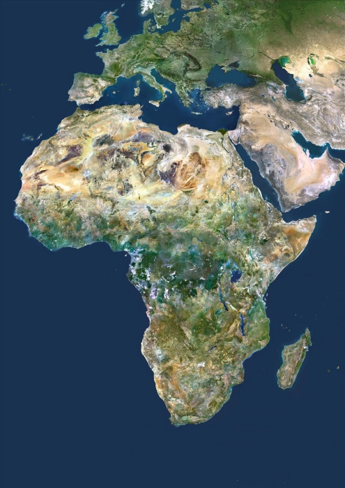
Africa, True Colour Satellite Image. Africa. True colour satellite image centred on Africa. North is at top. Water is blue, vegetation is green, arid areas are brown, and snow and ice are white. The terrain of Africa varies from rock and sand (grey and brown) in the Sahara in North Africa, to tropical rainforests (dark green) in Western and Central Africa, and savannah and plains (brown and green) in southern and eastern Africa. Surrounding Africa (clockwise from top) is Europe and the Mediterranean, the Arabian Peninsula, the Indian Ocean, the island of Madagascar, and the Atlantic Ocean. The image used data from LANDSAT 5 & 7 satellites.
| px | px | dpi | = | cm | x | cm | = | MB |
Details
Creative#:
TOP09061624
Source:
達志影像
Authorization Type:
RM
Release Information:
須由TPG 完整授權
Model Release:
NO
Property Release:
NO
Right to Privacy:
No
Same folder images:
 Loading