
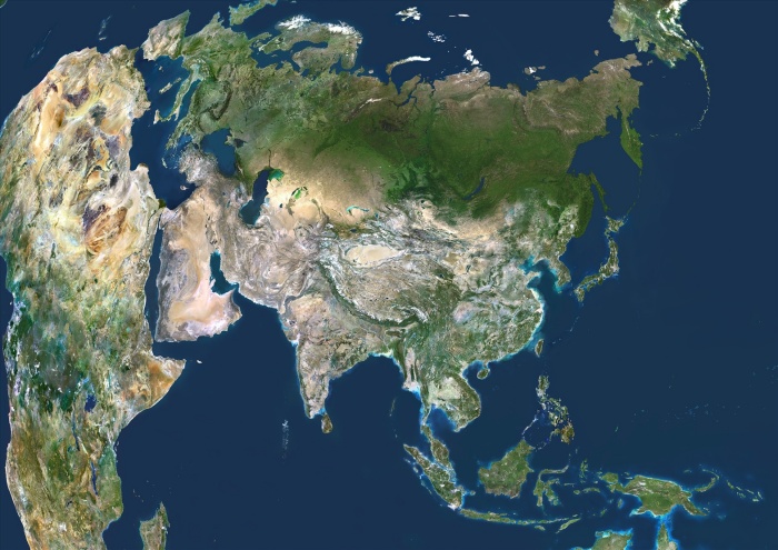
Asia, True Colour Satellite Image. Asia. True colour satellite image centred on Asia, with nearly all of Africa (down left) and Europe (upper left) seen. This image shows the curvature of the Earth, with north-south lines converging towards top. The terrain of Asia varies from deserts (brown, central and southern Asia), to tropical rainforests (dark green, South-East Asia and the Malay Archipelago), to grasslands, forests and tundra (lighter green, northern Asia), and mountain ranges (centre). Also seen is the Arctic (top), Alaska (top right), and the Pacific Ocean (right) and Indian Ocean (lower left). The image used data from LANDSAT 5 & 7 satellites.
| px | px | dpi | = | cm | x | cm | = | MB |
Details
Creative#:
TOP09061623
Source:
達志影像
Authorization Type:
RM
Release Information:
須由TPG 完整授權
Model Release:
NO
Property Release:
NO
Right to Privacy:
No
Same folder images:
 Loading