
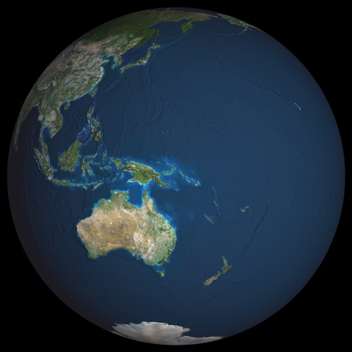
Globe Oceania, True Colour Satellite Image. Earth. True colour satellite image of the Earth, centred on the region of Oceania. North is at top. Water is blue, vegetation is green, arid areas are brown, and snow and ice are white. Both land and ocean floor topography are shown. Shallow coastal waters are light blue. Oceania consists of small islands scattered around the western Pacific Ocean. Archipelago (centre left). Australia (lower left), New Zealand (lower right), part of mainland Asia (top left), the Mala and Antarctica (bottom centre), are also seen. Deserts are seen in the Australian interior, and tropical forests along the Australian coast and in the islands of the Malay Archipelago. The image used data from LANDSAT 5 & 7 satellites. Print size 42x42cm.
| px | px | dpi | = | cm | x | cm | = | MB |
Details
Creative#:
TOP09061614
Source:
達志影像
Authorization Type:
RM
Release Information:
須由TPG 完整授權
Model Release:
NO
Property Release:
NO
Right to Privacy:
No
Same folder images:
 Loading