
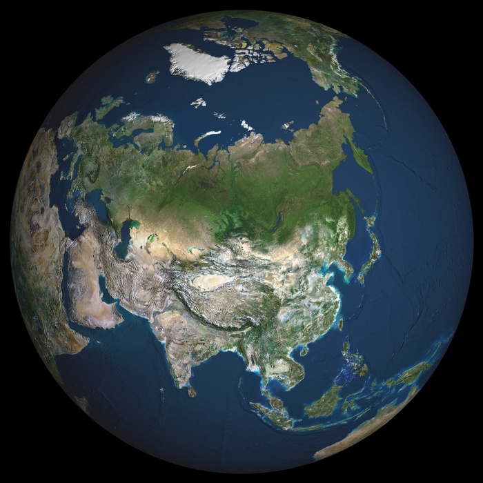
Globe Asia, True Colour Satellite Image. Earth. True colour satellite image of the Earth, centred on Asia. The North Pole is at upper centre. Water is blue, vegetation is green, arid areas are brown, and snow and ice are white. Both land and ocean floor topography are shown. The terrain of Asia varies from deserts (brown, central and southern Asia), to tropical rainforests (dark green, South- East Asia), to plains, forests and tundra (lighter green, northern Asia), and mountain ranges (lower centre). Surrounding mainland Asia (clockwise from top) is the Arctic Ocean (with Greenland and North America beyond), the Pacific Ocean, the Malay Archipelago and northern Australia, the Indian Ocean, north-eastern Africa, and Europe. The picture is a composite created from thousands of separate images recorded by LANDSAT 5 & 7 satellites. Print size 42x42cm.
| px | px | dpi | = | cm | x | cm | = | MB |
Details
Creative#:
TOP09061613
Source:
達志影像
Authorization Type:
RM
Release Information:
須由TPG 完整授權
Model Release:
NO
Property Release:
NO
Right to Privacy:
No
Same folder images:
 Loading