
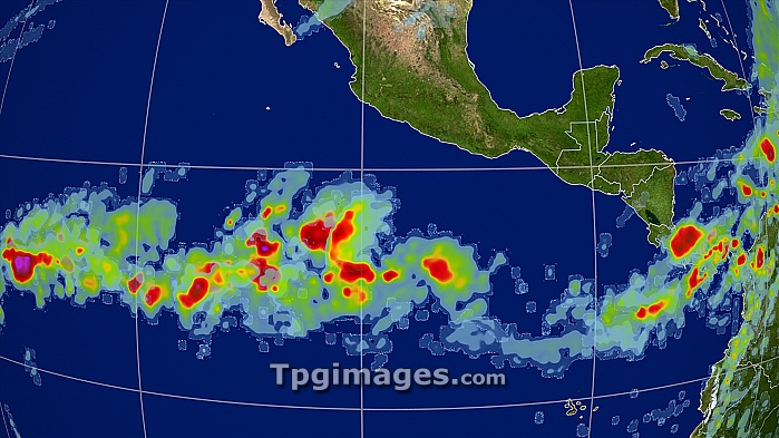
Rainfall levels. Satellite image showing precipitation levels over the Central America on 8th November 2004. Amount of precipitation, measured in millimetres, is colour-coded from green (lowest) through yellow, orange and red to purple (highest). Rain across the middle of the Pacific Ocean, as seen here, is typical of an El nino year. El Nino is a warming of surface waters in the tropical eastern Pacific Ocean. It may persist for a year or more, and causes drier conditions in Australia and South-East Asia, and wetter and warmer conditions in the Americas, with often dire effects for agriculture. Data from NASA's Global Precipitation Measurement (GPM) mission.
| px | px | dpi | = | cm | x | cm | = | MB |
Details
Creative#:
TOP07425965
Source:
達志影像
Authorization Type:
RM
Release Information:
須由TPG 完整授權
Model Release:
NO
Property Release:
NO
Right to Privacy:
No
Same folder images:
 Loading