
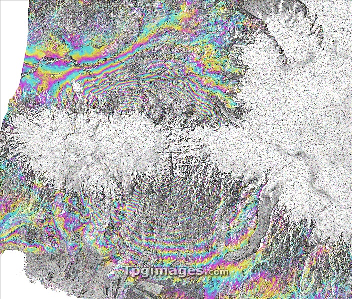
Eyjafjallajokull volcano, Iceland, satellite radar image. North is at top. The ash from the volcanic eruptions under the Eyjafjallajokull in March and April 2010 caused the closure of large parts of European airspace for several days. Here, radar interferometry shows ground deformation (coloured fringes). The ground uplifted by more than 40 centimetres prior to the main eruption on 14 April 2010. This area, around 32 kilometres across, was imaged by the TerraSAR-X satellite on 18 June 2009 and 11 April 2010. TerraSAR-X is a European satellite that uses X-band (microwave) synthetic aperture radar (SAR) to observe the Earth from space.
| px | px | dpi | = | cm | x | cm | = | MB |
Details
Creative#:
TOP07422256
Source:
達志影像
Authorization Type:
RM
Release Information:
須由TPG 完整授權
Model Release:
NO
Property Release:
NO
Right to Privacy:
No
Same folder images:
 Loading