
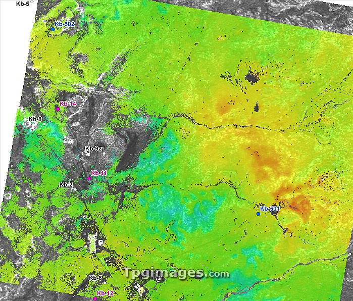
Oil industry, satellite radar image. This oil drilling area, near In Salah, Algeria, includes gas production sites (pink dots) and carbon dioxide injection sites (blue dots). Carbon dioxide from drilling is injected into deep rocks to reduce greenhouse gas emissions. The radar shows ground movements ranging from red (uplift of 6.5 mm/year) through yellow and green to blue (subsidence of 6 mm/year). This area, 14 kilometres across, was imaged by the TerraSAR-X satellite between 15 March 2008 and 29 May 2009. TerraSAR-X is a European satellite that uses X-band (microwave) synthetic aperture radar (SAR) to observe the Earth from space.
| px | px | dpi | = | cm | x | cm | = | MB |
Details
Creative#:
TOP07422254
Source:
達志影像
Authorization Type:
RM
Release Information:
須由TPG 完整授權
Model Release:
NO
Property Release:
NO
Right to Privacy:
No
Same folder images:
 Loading