
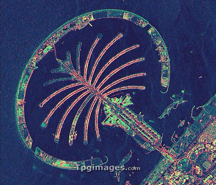
Palm Jumeirah, satellite radar image. North is at top. The Palm Jumeirah is a collection of artificial islands built in the shape of a palm tree on the Persian Gulf coast of Dubai, in the United Arab Emirates (UAE). Construction began in 2001, with some hotels and apartments in use by 2008. The colours in the image indicate different reflectivity of the radar used to obtain the image. This image, showing an area around 6.6 kilometres across, was obtained by the TerraSAR-X satellite on 16 March 2008. This is a European satellite that uses X-band (microwave) synthetic aperture radar (SAR) to observe the Earth from space.
| px | px | dpi | = | cm | x | cm | = | MB |
Details
Creative#:
TOP07422252
Source:
達志影像
Authorization Type:
RM
Release Information:
須由TPG 完整授權
Model Release:
NO
Property Release:
NO
Right to Privacy:
No
Same folder images:
 Loading