
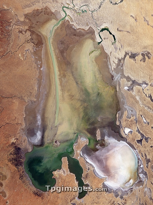
Lake Eyre wet period, satellite image. North is at top. This large, closed (endorheic) drainage basin is usually a salt flat, but when it fills with water is the largest lake in Australia. Located in South Australia, it has an area of 9500 square kilometres, but drains a much larger area of 1.2 million square kilometres. In 2009, rain over northern Australia caused the filling seen here. By June, the peak amount of flooding had taken place. The colours are due to sediment and algae, and the area also sustains birds and fish. This image, around 105 kilometres across, was obtained by the Thematic Mapper sensor on NASA's Landsat 5 satellite, on 10 June 2009.
| px | px | dpi | = | cm | x | cm | = | MB |
Details
Creative#:
TOP07420758
Source:
達志影像
Authorization Type:
RM
Release Information:
須由TPG 完整授權
Model Release:
NO
Property Release:
NO
Right to Privacy:
No
Same folder images:
 Loading