
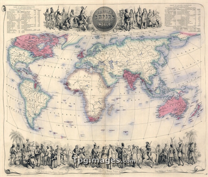
1850's map of the British Empire throughout the world, with illustrations of the inhabitant of the Empire. By the end of the century, African colonies would be expanded, and the Empire would reach it's maximum size.
| px | px | dpi | = | cm | x | cm | = | MB |
Details
Creative#:
TOP07369794
Source:
達志影像
Authorization Type:
RM
Release Information:
須由TPG 完整授權
Model Release:
NO
Property Release:
NO
Right to Privacy:
No
Same folder images:
 Loading