
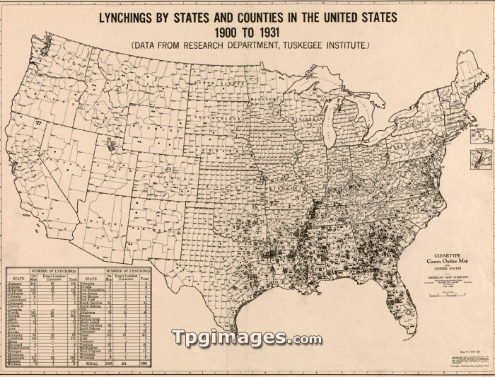
1931 map, based on statistical research of Tuskegee Institute, shows lynchings by states and counties in the United States, 1900-1931.
| px | px | dpi | = | cm | x | cm | = | MB |
Details
Creative#:
TOP07369789
Source:
達志影像
Authorization Type:
RM
Release Information:
須由TPG 完整授權
Model Release:
NO
Property Release:
NO
Right to Privacy:
No
Same folder images:
 Loading