
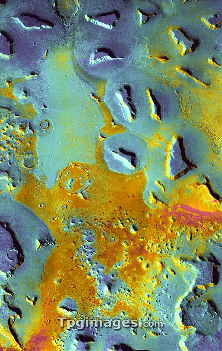
Martian surface. Coloured satellite image of mesas in the Deuteronilus Mensae region of Mars. Mesas are elevated landforms with flat tops and steep sides. It is thought that these mesas were formed when the ground collapsed due to subsurface water escaping through cracks and faults. Colours indicate nighttime temperatures, ranging from red (warmest) to blue (coolest). Areas covered in fine dust have cooled quickest and are blue, areas that have a mixture of rock and dust are warmer (yellow) and exposed rock is warmest (red). Image obtained by the Thermal Emission Imaging System (THEMIS) aboard NASA's Mars Odyssey orbiter.
| px | px | dpi | = | cm | x | cm | = | MB |
Details
Creative#:
TOP06673788
Source:
達志影像
Authorization Type:
RM
Release Information:
須由TPG 完整授權
Model Release:
NO
Property Release:
NO
Right to Privacy:
No
Same folder images:
 Loading