
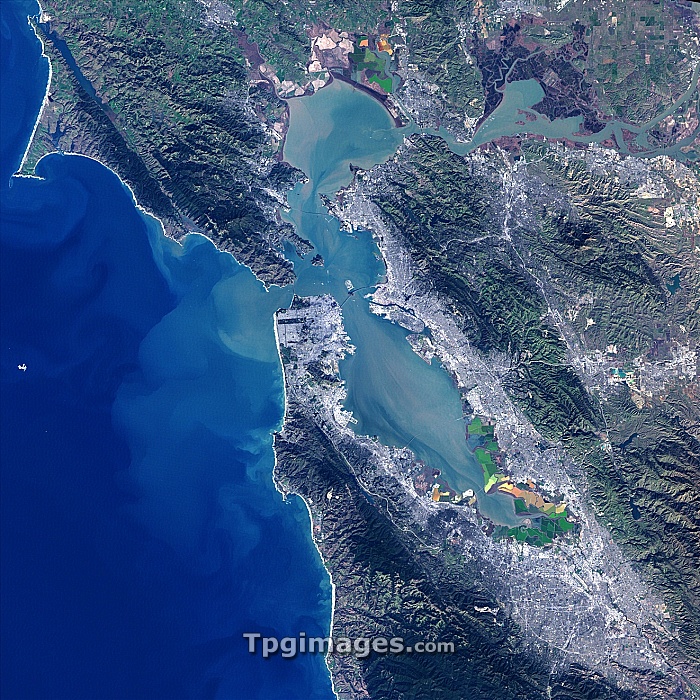
San Francisco Bay, USA. Satellite image of the San Francisco Bay area in California, USA. North is at top. The city of San Francisco is located on the tip of the San Francisco Peninsula (southern peninsula at upper left). Salt pans (multicoloured) can be seen on the southerly edge of the bay. Forested areas are dark green, bare ground is brown, urban areas are grey, and water is black. Image taken by the Landsat 7 satellite.
| px | px | dpi | = | cm | x | cm | = | MB |
Details
Creative#:
TOP06673593
Source:
達志影像
Authorization Type:
RM
Release Information:
須由TPG 完整授權
Model Release:
NO
Property Release:
NO
Right to Privacy:
No
Same folder images:
sanfranciscopacificoceanoceancitynorthamericausacoastcaliforniaearthobservationgeographysatelliteimagefromspacesatellitelandsat7americanbayareacoastalcoastlineforestforestsgeographicalnasapacificcoastpanssaltpansanfranciscopeninsulaunitedstatesurbanurbanisationurbanizationvegetationwaterwestcoastwoodlandwoods"
"7americaamericanareabaycaliforniacitycoastcoastcoastcoastalcoastlineearthforestforestsfranciscofranciscofromgeographicalgeographyimagelandsatnasanorthobservationoceanoceanpacificpacificpanpanspeninsulasaltsansansatellitesatellitespacestatesunitedurbanurbanisationurbanizationusavegetationwaterwestwoodlandwoods
 Loading