
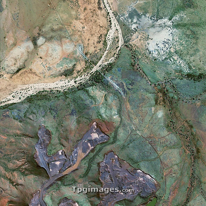
Australian ore mines, GeoEye-1 satellite image. This is part of the Yarrie mine complex, in Western Australia, a series of iron ore mines excavated using open-pit mining. This excavates and processes the surface material, leaving vast open pits (grey, bottom). A dry river bed and road are at upper left. This image is just over a kilometre across and shows the northern part of the Yarrie 10 mine complex. Image data obtained on 23 August 2009. The US-operated GeoEye-1 satellite was launched in September 2008, and orbits at a height of 680 kilometres. It is the world's highest resolution commercial Earth-imaging satellite.
| px | px | dpi | = | cm | x | cm | = | MB |
Details
Creative#:
TOP06673405
Source:
達志影像
Authorization Type:
RM
Release Information:
須由TPG 完整授權
Model Release:
NO
Property Release:
NO
Right to Privacy:
No
Same folder images:
 Loading